
ISSN (0970-2083)
ISSN (0970-2083)
Kanat Bayli1*, Mussabayev T.T2, Kayupov T3, and Seilhanova D.K.4
1Faculty of Economics, L.N. Gumilyov Eurasian National University, Astana, Kazakhstan.
2Doctor of Technical Sciences, Professor of the L.N. Gumilev Eurasian National University, General Director of State Urban Planning Enterprise» RSE, Kazakhstan.
3Candidate of Technical Sciences, Chief Engineer of State Urban Planning Enterprise» RSE, Kazakhstan.
4Senior Lecturer in L.N. Gumilev Eurasian National University, Kazakhstan.
Received 25 October, 2017; Accepted 20 September, 2018
Visit for more related articles at Journal of Industrial Pollution Control
This article provides the use of analytical tools of territorial planning to situational modeling of regional socio-economic processes on the example of the building Buzuluk reservoir. To eliminate subjective assessment of expert’s weights cognitive map model defined by cybernetic method - active algorithm Hebb for neural networks, taking into account the dynamics of more than 250 interconnected indicators of socio-economic, environmental and natural-climatic condition of the region for 10 years. The proposed tool can be used for management decision-making in the planning and operation of a single object or a strategic program for the development of a given region or country as a whole. Users of this model can act as government officials in the development of strategies and programs of regional development, experts, analysts, and developers of urban development projects.
Spatial planning, Water supply, Reservoir, Irrigated agriculture, Situation modeling, Fuzzy, Cognitive map, Cybernetic tools, Training of neural networks, Process of development of the regions.
This article proposes an analytical tool that allows you to build a forecast of development of the regions of Kazakhstan at the time of occurrence and elimination of various situations on a regional scale. The authors suggest that this approach can be applied to any object of the administrative-territorial division of the presence of statistics for a certain period.
With the help of the developed analytical tools and computer program conducted situational modeling of regional socio-economic processes related to the implementation of the project of construction of the Buzuluk reservoir in Akmola region in compliance with the sustainable development and efficient management of the region. Results of the study are shown in the form of a fuzzy cognitive map, which reflects the internal and external communication in the region, the development schedules of socioeconomic factors and criteria of (Bossel, 1999). Simulating financial investments led to a positive result: the improvement of GRP, employment and environmental conditions.
Worldwide availability of water largely influences on the level and quality of life. Even now Kazakhstan begins to experience water shortages and projected in 20-25 years may face a significant shortage of water resources. One of the main components of the forecast - is the perspectives of economic growth of neighboring countries with Kazakhstan.
The growing severity of the problem of water supply due to:
• Formation of over 45% of surface runoff outside the country and increasing their seizure in neighboring countries (China, Uzbekistan, Kyrgyzstan, Russia);
• Uneven distribution of the rivers on the territory of the republic;
• Impact on the runoff of global and regional climate changes;
• High degree of pollution of the water bodies.
Decree of the President of the Republic of Kazakhstan dated April 4, 2014 âïÿý?ïÿý? 786 approved the State program of water resources management in Kazakhstan (State Water Management Program, 2014). The main objective of the program - is to ensure water security in Kazakhstan by improving the efficiency of water use. It outlined the main directions and ways to achieve the objectives of the Program.
One of the measures is the creation of new reservoirs of water to reduce the deficit, the artificial replenishment of groundwater reserves, increasing available water resources by interbasing transfers of water flow.
In his message, the President of Kazakhstan "Strategy - 2050" shortage of water resources is seen as a global threat (Strategy "Kazakhstan - 2050", 2012; Stylios and Groumpos, 2004). At the same time, to the Government faces challenges to ensure a stable water supply of the population (in 2020) and agriculture (2040), and by 2050 to solve all problems with water resources in the regions. In order to achieve sustainable socio-economic development of regions requires appropriate changes and new approaches in the use of water resources (General scheme of organization, 2012). The is one of the poorest according to the calculations of water management of water availability under consideration of water of swimming pools and areas of Esil pool by the presence of water. A large pool area is already experiencing a shortage of both surface and underground waters.
In this article, taking into account the proposals of the General scheme of the organization of the country considered the need to build Buzuluk reservoir in the middle reaches of the river Esil (The General Scheme, 2013; The regional development program, 2014). Construction Buzuluk reservoir of useful capacity of 1.0 km3 or 2-3 reservoirs with specified capacity will also solve the problem of providing releases guaranteed in the Russian Federation in the low-flow period of extremely dry years with a water flow of not less than 10 m3/s.
Choice of the optimal reservoir capacity is made on the basis of the analysis of the water situation in the basin, topographic characteristics of the planned capacities, areas of flooding and flooding of settlements, removal and construction of cars - and the railway and other linear objects as well as to evaluate the viability and balance the socio-economic and ecological condition application.
Study of the construction site of the reservoir using a profile GoogleMap terrain data (https://www.google.kz/maps/@49.5219664,68.6505615,5z?hl=ru). (Fig. 1) gave the following results: at an altitude of 220 m water table will pond, consisting of 20 small lakes. The green line on the profile area (Fig. 1) indicates that the water rise to the level of 225 m below the water remains village Kursk, farmland, roads and bridges; at the level of the water surface of 230 m pond is obtained from the 3 lakes and in the flood, zone is only one village - village Kursk (Fig. 1). But with half usable capacity of 1.0 km3 is not achieved, as well as in the area of flood risk, depending on the climate in the autumn and spring periods are 7 settlements and farmland that require significant costs for protective measures; at the level of 240-meter water reservoir created, but in the flood zone are 8 settlements: Dvurechnoe, Kursk, Pyatigorsk, Tasotkel, Priishimka, Ushkarasu, Otradnoe, Kenskoe. On the upper reaches of the reservoir at the bottom of village Gastello along the river need to finish before the natural dam elevation. 245 m. To build reservoir for village Derzhavinsk does not have any threats (Fig. 2).

Fig. 1 One of the lakes at the level of the water reservoir mirror m 220.000 (the black line indicates the position of the profile on the map, the green marker indicates the place of the shooting elevation, above - the profile of the terrain and the location` shooting green line).

Fig. 2 Profiles of the terrain on the upper reaches of the Buzuluk reservoir a) Profiles of the terrain near the village Gastello, b) Profiles of the terrain near the village Derzhavinsk.
Of the above options for technical and economic parameters, preference was given to the reservoir at the level of 240 meter with the characteristics: capacity - 1.0533 billion m3, including dead volume - 57.3 million m3 of associated gas - 240 meter, GMO - 220 meter, the crest dam - 245 meter, the surface area for a given NPG - 182.9 km2, GMO - 18.1 km2. Estimated investment in the construction and preparation of the reservoir cup (flooded area - 13700 ha) 49.2 million tenge. In the flood zone fall: agricultural land - 14815 ha, eight localities, power lines - 74 km, communication lines - 64 km, 16 km of railways and 92 km of roads.
Based on the current water situation in the basin, taking into account the prospects of development of the branches of the reservoir area of the construction of the most successful economy is the site of the town of Ishim Derzhavinsk to the following reasons (Fig. 3): convenience in providing water supply for Esil industrial area; presence in this land area, possible to use for ameliorative reasons; relatively prosperous topographical and geological conditions; the ability to control a large part of the lateral inflow (rivers Koluton and Tersakkan toad and others.)

Fig. 3 Map - Circuit design arrangement Buzuluk reservoir.
Feasibility and timeliness of construction Buzuluk reservoir on the river. Esil in Akmola region is confirmed:
• First, changes in the natural climatic conditions and based on the need to improve the drinking water supply for the population of Astana, Akmola, Kostanai and North Kazakhstan regions, increase agricultural production through the development of irrigated land, as well as the multiplier effect in the industrialization of the region;
• Secondly, it will eliminate risks and reduce the dependence of Kazakhstan from the water inflow from the territory of neighboring states;
• Thirdly, the problem of optimal regulation of interbasin transfer of runoff will be solved. Esil and provide controlled release of water into the Russian Federation in accordance with intergovernmental agreements;
• Fourth, Buzuluk reservoir will allow involving in turn large areas of land above three areas that are suitable for use in reclamation purposes; implement existing development prospects of the mining and processing industries and agriculture. For the construction of the dam, you can use the natural profile of the terrain, which creates a barrier on the level of 250 m at a distance of 1 km from the claim Buzuluk (Fig. 4).

Fig. 4 Estimated location dam Buzuluk reservoir.
In order to study the possibility of solving the mentioned task in a software module situational modeling analytical tools of spatial planning on the basis proposed in the article "Situational modeling of development of Kazakhstan regions" (Musabaev, et al., 2017), theories of situational model construction Buzuluk reservoirs were built, the development of water supply to Akmola region and identifies possible impacts of the decision on the socioeconomic development and the ecological condition of the region.
It is impossible to judge the prospects of the current project, without knowing how much the efficiency of its implementation and on what indicators can affect the region. Determine its impact on the social, economic and environmental situation in the region identified the strengths and weaknesses of the project.
Effective tool and a promising method of situational modeling are fuzzy cognitive maps (Axelrod, 1976; Bossel, 1999; Glykas, 2010; Kayupov, et al., 2015; Kosko, 1993; Leon, 2010; Oja, et al., 1991; Papageorgiou, et al., 2013; Papageorgiou, et al., 2012; Roberts, 1986; Sadovnikova, et al., 2014; Musabaev, et al., 2017), showing the relationship between the very different concepts, processes, parameters; It has the flexibility in the system design, modeling and control; may find application in the study of behavioral problems and the most complex systems. Cognitive map enables us to trace the relationship between the future, the present and the past of the studied process.
For situational modeling construction Buzuluk reservoir used cybernetic tools based on fuzzy cognitive map (Kayupov, et al., 2015; Musabaev, et al., 2017).
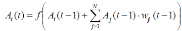 (1)
(1)
where Ai(t) - the value of the concept; wij - the weight concept coupling coefficient Aj with the concept of Ai; f - sigmoid function, t - time.
For training cognitive map used an element of artificial intelligence - active Hebbian learning algorithm for neural networks (Hebb, 1949).
 (2)
(2)
where η and γ - parameters learning pace (Kayupov, et al., 2015; Papageorgiou, et al., 2013; Papageorgiou, et al., 2012; Musabaev, et al., 2017).
Fine-tuning fuzzy cognitive map is achieved by changing training sequence determined using a rank scale and sorting algorithm T. Saaty (Kayupov, et al., 2015; Musabaev, et al., 2017). A detailed presentation of the situational modeling techniques presented in (Musabaev, et al., 2017).
Furthermore, a study of situational behavior patterns in different types of accounting impact pulses within a single situation - building Buzuluk reservoir:
1) Examined separately the situation of increasing irrigated areas and the development of agricultural production;
2) The construction of hydroelectric power stations on the dam Buzuluk reservoir;
3) In the third embodiment discussed above the joint impact of the two options.
According to PC "Institute Kazgiprovodkhoz" area of regular irrigation district. Esil given flow regulation Buzuluk reservoir - 43,44 thousand hectares allocated amount of investment 49.2 billion tenge. Taking into account existing in the Akmola region irrigated land 38 thousand ha, for increase of 41%.
Consider the first version of the situation with the supply of pulses to the investment where the investment amount allocated is distributed in: agriculture 1.7 billion tenge, processing industry 7.5 billion tenge, water 2.9 billion tenge, construction 0.9 billion tenge, transport and storage 12.4 billion tenge, other services 0.6 billion tenge, the cost of the local budget 23.2 billion tenge (Table 1).
| ID | Code | Name | Year | Value | Pulse | % |
|---|---|---|---|---|---|---|
| 9 | 24 | Investments in agriculture, million tenge | 2013 | 22102.00 | 1673.2 | 7.570534 |
| 10 | 26 | Investments in manufacturing, million tenge | 2013 | 28822.00 | 7534.8 | 26.1426 |
| 11 | 28 | Investments in water supply, million tenge | 2013 | 12946.00 | 2935.7 | 22.67645 |
| 12 | 29 | Investments in construction, million tenge | 2013 | 408.00 | 869.4 | 213.0858 |
| 13 | 31 | Investments in transport and storage, million tenge | 2013 | 14723.00 | 12406.8 | 84.2681 |
| 14 | 42 | Investments in other services, million tenge | 2013 | 597.00 | 622.1 | 104.211 |
| 15 | 44 | Local budget expenditures , million tenge | 2013 | 151066.00 | 23190.1 | 15.35095 |
| 16 | 242 | Irrigation area, thousand ha | 2013 | 38.00 | 15.6 | 41 |
Table 1. Pulse was applied in the construction of the Buzuluk reservoir (1 variant).
Analysis of the results of the economic subsystem allows to conclude that the observed improvements in the region's economy. The growth of irrigated areas has influenced the increase in construction (103.36%), transport (32.53%), the gross output of agricultural products (17.38%), the gross harvest of agricultural crops (10.91%). Improving the provision of livestock pastures has led to an increase in the volume of livestock production: the production of milk, meat and wool (by 7.71%).
However, in the field of agricultural development has a revitalizing effect on the economic indicators such as gross regional product (21.32%), the volume of trade (19.13%), exports (11.45%) and imports (5.23%). The growth of imports of goods, primarily due to the purchase of equipment and the indirect influence of population growth (Fig. 5).

Fig. 5 Figure guidelines for the economic sub-option of the variant 1.
Polygon sustainable development Bossel shows that the construction of the Buzuluk reservoir at a momentum increase irrigated land improved almost all the landmarks except adaptability.
Also improves and social situation in the region. The main and the resulting fundamental factor is the increase in the number of employed populations by 16.2%, namely in construction 86.7%, transport and warehousing - 21.55%, agriculture at 15.02%, wholesale and retail trade – 15.64%, and in other sectors due to migration growth at 24.85%. At the same time the population of the arrival increased by 16.22% and decreases disposal to 12.53% due to the creation of new jobs in different fields (construction, electricity, agriculture and the social sphere). In turn, the increase in the arrival of the population in the region leads to an increase in the number of economically active population (11.28%), the Human Development Index (HDI to 16.23%), and other important figures in the region. Construction of the reservoir will affect the reduction of the depth, severity of poverty (over 10%), crime (11.48%) and the index of social tensions (7.55%) (Fig. 6).

Fig. 6 Figure guidelines for social sub-option of the variant 1.
In the field of ecology observed increase in the use of water for irrigation volume (12.33%), water intake from natural sources (4.32%). In consequence, revealed little negative impact on the increase of production and consumption waste (0.58%), discharge of polluted wastewater into surface water bodies (0.33%). Given the worn-out and obsolete irrigation system, an increase in water pollution index (0.38%) in this case is inevitable (Fig. 7).

Fig. 7 Graph guidelines for environmental sub-option of the variant 1.
Situation analysis of simulation results construction of the Buzuluk reservoir of the first embodiment shows that the stability of the system will improve by 2.8%. In this case, the system will improve the viability of 8.45%, namely the economic subsystem is improved by 10.76%, social subsystem - 11.39%, environmental subsystem - 2.43%, despite the fact that the balance of the system in general deteriorates slightly 1.03% due to the artificial replenishment of water supply for irrigated agriculture in the local stock (Table 2).
| Variables | Economic development | Social sphere | Environmental condition | The entire system | Average | |
|---|---|---|---|---|---|---|
| Self-development | ks | 1.2567 | 1.1183 | 1.1298 | 1.1683 | 1.5497 |
| kf | 1.9395 | 1.9512 | 1.903 | 1.9312 | ||
| Current situation | ks | 1.4083 | 1.2621 | 1.1579 | 1.2761 | 1.5938 |
| kf | 1.8911 | 1.9293 | 1.9142 | 1.9116 | ||
| Difference | ks | 10.764% | 11.392% | 2.431% | 8.45% | 2.767% |
| kf | -2.556% | -1.131% | 0.589% | -1.027% | ||
Table 2. Results of evaluation parameters from the coefficients of system stability-ks and viability of the balance -kf (variant 1).
Analysis of the concept of a cognitive map "of the local budget expenditures" (Fig. 8) showed that it depends on the 9 factors with different weighting factors and influences on the concept of "Investment in fixed assets" with a weighting factor of 0.181.

Fig. 8 The cognitive concept map "of the local budget expenditures".
Analysis of the concept of a cognitive map "Irrigation Area" (Fig. 9) showed that it depends on the concept of "Average selling prices for wheat" with a weighting factor of 0.072 and affects 5 concepts with different weights.

Fig. 9 The cognitive map concept "area irrigated".
Analysis of the concept of a cognitive map "Investments in the construction" (Fig. 10) showed that it affects "The volume of construction works" with a weighting factor of 0.484 and on the concept of "Investment in fixed assets" with a weighting factor of 0.007. Many of these investment concepts have the same structure with other weights.

Fig. 10 The cognitive map concept "Ðïÿý?nvestments in the construction".
Analysis of the concept of a cognitive map "Investing in the agriculture" (Fig. 11) showed that it affects all agricultural products with different weights on the concept of "Investment in fixed assets" with a weighting factor of 0.013. You can observe the interaction of various agricultural products.

Fig. 11 The cognitive map concept "Investing in agriculture".
Analysis of cognitive maps of the situation, "The increase in irrigated area" (Fig. 12) showed that all the pulses forms a dense network of relationships, creating more than 10 sectors of employment, 7 branches of agriculture and the development of more than 8 branches, creating a gross regional product; there are different types of services and goods.

Fig. 12 The cognitive map of the situation, "The increase in irrigated area".
Analysis of satellite images showed that the construction of the Buzuluk reservoir will be submerged 5 settlements, transport infrastructure and farmland. And also on the dam will be built hydroelectric power capacity of 5.5 MW. The relocation of the population flooded settlements requires significant efforts to develop a package of social measures, including provision of the population living space, real estate, banking and financial services, health care, and others.
In the second embodiment, the construction situation Buzuluk reservoir is considered a theoretical (synthetic), the situation of the full pulse setting (variant 3), were not included in the 1 variant. This pulse is applied to the increase in investment in electricity supply, investment in the social, scientific and administrative sectors of activity, a decrease in agricultural land of 15.2 hectares at the expense of the flooded area of the reservoir, migration flows from the disposal of the population of flooded settlements, the construction of a residential area and resettlement (arrival) them in other localities of Akmola region and the proportion of disturbed land (flooding farmlands, settlements, power lines, communication lines, railways and motorways).
Accounting for these factors give the following situation related event (Table 3).
| ID | Code | Name | Year | Value | Pulse | % |
|---|---|---|---|---|---|---|
| 124 | 27 | Investments in electric power, million tenge | 2013 | 14210.00 | 4035.6 | 28.3996 |
| 125 | 33 | Investment in information and communications, million tenge | 2013 | 1654.00 | 154.4 | 9.332076 |
| 126 | 34 | Investments in financial and insurance activities, million tenge | 2013 | 369.00 | 416.3 | 112.8191 |
| 127 | 35 | Investments in real estate transactions, million tenge | 2013 | 12966.00 | 1456.3 | 11.2315 |
| 128 | 36 | Fixed capital investments in science, million tenge | 2013 | 1189.00 | 1033.4 | 86.90991 |
| 129 | 37 | Investments in the field of adm. and Aux. service, million tenge | 2013 | 1476.00 | 740.4 | 50.16137 |
| 130 | 38 | Investments in management, defense and social security, million tenge | 2013 | 651.00 | 916.4 | 140.7707 |
| 131 | 40 | Investments in health care, million tenge | 2013 | 1853.00 | 947.6 | 51.13828 |
| 132 | 43 | Investment in housing construction, million tenge | 2013 | 12149.00 | 1004.9 | 8.271479 |
| 133 | 122 | The area of agricultural lands, thousand ha | 2013 | 10540.00 | -15.2 | -0.1442125 |
| 134 | 181 | Camed, man | 2013 | 13492.00 | 1349.2 | 10 |
| 135 | 182 | Retired, man | 2013 | 15467.00 | 2320 | 15 |
| 136 | 228 | The proportion of damaged land, ha | 2013 | 17005.00 | 1003.3 | 5.9 |
Table 3. Pulse was applied in the construction of the reservoir (variant 2).
Analysis of the economic subsystem 2 variants of the situation reveals that the region's economy has been a slight improvement, namely investment in electricity influenced the growth in production of electricity at 8.21%, construction volume by 5.51% in fixed capital investments 5.28% by acquisition of appropriate equipment for the construction of hydroelectric power plants, power plants increase by 1.12%. Thus, it is necessary to draw attention to the fact that the increase in GRP (0.72%) small compared to the volume increase of GRP in the variant 1 (Fig. 13).

Fig. 13 Figure guidelines for the economic sub-option of the variant 2.
Polygon sustainability by Bossel shows that the construction of the Buzuluk reservoir feeding pulse to increase investment in the construction of hydroelectric power plants there is a slight improvement on the benchmarks of efficiency and existence.
Despite the increase in employment in electricity (5.99%), construction (4.53%), health (0.66%) and industry (0.86%), the social position of the polygon Bossel sustainable development of the region will deteriorate slightly by landmarks coexistence. By increasing the total area of commissioned residential buildings on a 3.05% increase living space fund by 2.53%. Despite some improvement in the region, the construction of hydropower plants has a negative impact on the number of diseases and increase it to 1.31%, the number of deaths at 0.53%, reduced migration gain of 3.52% (Fig. 14).

Fig. 14 Figure guidelines for social sub-option of the variant 2.
The ecological status of the region after the construction of the Buzuluk reservoir at 2-pulse variant slightly deteriorates landmarks existence and security due to the fact that the increased water pollution index (1.02%), the proportion of water samples that do not meet the standards (0.8%), emissions of pollutants into the atmosphere (0.09%) and other minor figures (Fig. 15). It follows that the construction of hydroelectric power plants adversely affects the ecological status of the region than just an increase in irrigated area, a 1-form.

Fig. 15 Graph guidelines for environmental sub-option of the variant 2.
Situation analysis of simulation results construction of the Buzuluk reservoir of the second embodiment shows that the stability of the system will deteriorate slightly by 0.05%; at the same time, the system will improve the viability of 0.31%, the balance deteriorated by 0.28%. Despite the fact that the economic viability by subsystem increases by 1.4%, the deterioration of the balance is observed at 0.47%. Social subsystem worsen viability by 0.03% and the balance of 0.2%. Similarly, the environmental assessment of the subsystem deteriorates (vitality - 0.57%, the balance - 0.14%) (Table 4).
| Variables | Economic development | Social sphere | Environmental condition | The entire system | Average | |
|---|---|---|---|---|---|---|
| Self-development | ks | 1.2567 | 1.1183 | 1.1298 | 1.1683 | 1.5497 |
| kf | 1.9395 | 1.9512 | 1.903 | 1.9312 | ||
| Current situation | ks | 1.2746 | 1.118 | 1.1233 | 1.1719 | 1.5889 |
| kf | 1.9304 | 1.9467 | 1.9003 | 1.9258 | ||
| Difference | ks | 1.399% | -0.031% | -0.573% | 0.314% | -0.055% |
| kf | -0.471% | -0.228% | -0.14% | -0.28% | ||
Table 4. Pulse was applied in the construction of the reservoir (variant 2).
Consider three-option situation Buzuluk reservoir construction with total feed pulses of the previous two options (Table 5). With this investment the size remains the same, part of the invested funds is reallocated to a social event on the second version.
| ID | Code | Name | Year | Value | Pulse | % |
|---|---|---|---|---|---|---|
| 103 | 24 | Investments in agriculture, million tenge | 2013 | 22102.00 | 1309.4 | 5.924377 |
| 104 | 26 | Investment in the manufacturing industry, million tenge | 2013 | 28822.00 | 5896.4 | 20.45808 |
| 105 | 27 | Investments in electric power, million tenge | 2013 | 14210.00 | 4035.6 | 28.3996 |
| 106 | 28 | Investments in water supply, million tenge | 2013 | 12946.00 | 2297.3 | 17.74562 |
| 107 | 29 | Investments in construction, million tenge | 2013 | 408.00 | 680.3 | 166.7518 |
| 108 | 31 | Investments in transportation and warehousing, million tenge | 2013 | 14723.00 | 9709 | 65.94463 |
| 109 | 33 | Investment in information and communications, million tenge | 2013 | 1654.00 | 154.4 | 9.332076 |
| 110 | 34 | Investments in financial and insurance activities, million tenge | 2013 | 369.00 | 416.3 | 112.8191 |
| 111 | 35 | Investments in real estate transactions, million tenge | 2013 | 12966.00 | 1456.3 | 11.2315 |
| 112 | 36 | Fixed capital investments in science, million tenge | 2013 | 1189.00 | 1033.4 | 86.90991 |
| 113 | 37 | Investments in the field of adm. and Aux. service, million tenge | 2013 | 1476.00 | 740.4 | 50.16137 |
| 114 | 38 | Investments in management, defense and social security, million tenge | 2013 | 651.00 | 916.4 | 140.7707 |
| 115 | 40 | Investments in health care, million tenge | 2013 | 1853.00 | 947.6 | 51.13828 |
| 116 | 42 | Investments in other services, million tenge | 2013 | 597.00 | 486.9 | 81.55106 |
| 117 | 43 | Investment in housing construction, million tenge | 2013 | 12149.00 | 1004.9 | 8.271479 |
| 118 | 44 | The costs of the local budget, million tenge | 2013 | 151066.00 | 18147.6 | 12.013 |
| 119 | 122 | The area of agricultural lands, thousand ha | 2013 | 10540.00 | -15.2 | -0.1442125 |
| 120 | 181 | Came a man | 2013 | 13492.00 | 1349.2 | 10 |
| 121 | 182 | Retired man | 2013 | 15467.00 | 2320 | 15 |
| 122 | 228 | The proportion of damaged land, ha | 2013 | 17005.00 | 1003.3 | 5.9 |
| 123 | 242 | Irrigation Area, thousand ha | 2013 | 38.00 | 15.6 | 41 |
Table 5. Pulse was applied in the construction of the reservoir (variant 3).
Analysis of the economic sub-option 3 shows a positive impact on the region, taking into account both pulses. At the same time, it improved in almost all areas except for guidance adaptability because that improves the volume of construction to 86.41%, transportation at 25.46%, 18.36% of GRP, the volume of trade in the 17.04%, agriculture – 16.19%, investment in fixed assets - 17.03%, exports - 10.23% and other areas (Fig. 16).

Fig. 16 Figure guidelines for the economic sub-option of the variant 3.
In this case, in the social sphere the rise of the employed population (14.05%), namely in construction (71.92%), in transport and warehousing - 16.85%, agriculture – 13.92%, wholesale and retail trade - 13.87%, and other sectors of the economy. Due to create jobs in the region will increase migration flow to 17.25% and, respectively, the number of economically active population at 9.78%.
As seen in the second embodiment, the construction of hydroelectric power plants adversely affects the status of the region; accompanying measures such as the increase in the areas of irrigation, investing in housing, transport, communication, health, science, water, electricity, real estate has a positive effect on the general state of the social sphere. This can be seen in the polygon of Bosselya stability, improved in almost all areas of landmarks (Fig. 17).

Fig. 17 Figure guidelines for social sub-option of the variant 3.
Influence of reservoir construction on the ecology of the region, with both pulse feeding has a positive effect on the freedom of action, while slightly negative impact on the existence and security of the system (Fig. 18). As a result, we can conclude that: consideration of all the factors involved in the implementation of the situation, gives a more realistic and informative results that are significant.

Fig. 18 Graph guidelines for environmental sub-option of the variant 3.
On average, the system will improve the stability of 2.42%. This will improve the viability of the system - by 7.56% in terms of improving: economic development for 10.44%, the social sphere to 9.59% and the ecological status of 1.89%. Slightly worsen the balance of system (0.97%) on economic development by 2.52%, 0.88% of social sphere and improve the ecological condition of 0.45% (Table 6).
| Variables | Economic development | Social sphere | Environmental condition | The entire system | Average | |
|---|---|---|---|---|---|---|
| Self-development | ks | 1.2567 | 1.1183 | 1.1298 | 1.1683 | 1.5497 |
| kf | 1.9395 | 1.9512 | 1.903 | 1.9312 | ||
| Current situation | ks | 1.4032 | 1.2369 | 1.1515 | 1.2638 | 1.5882 |
| kf | 1.8918 | 1.9342 | 1.9116 | 1.9126 | ||
| Difference | ks | 10.436% | 9.587% | 1.887% | 7.563% | 2.422% |
| kf | -2.519% | -0.875% | 0.454% | -0.974% | ||
Table 6. Results of evaluation parameters from the coefficients of system stability-ks and viability of the balance -kf (variant 3).
Thus, the construction of the Buzuluk reservoir will solve several problems:
• Firstly, in the changing natural climatic conditions (increase in irrigation areas) will improve the drinking water supply to the population of the region will be able to solve the problems with water supply, increase agricultural production through the development of irrigated land, and will be possible to implement the existing prospects of development of energy, mining and processing industries;
• Secondly, this decision will eliminate risks and reduce the dependence of Kazakhstan from the water inflow from the territory of neighboring states;
• Thirdly, the problem of providing controlled release of water will be solved in the Russian Federation in accordance with intergovernmental agreements.
Therefore, this project will solve the problems of regulating the free flow p. Ishim, to guarantee water supply industry, the population of cities and rural settlements, as well as the water supply for the development of irrigated agriculture in the local stock, for a long period to ensure sustainable economic and social development of the neighboring regions, to create more jobs, increase export capacity, improve security and the relationship with other regions of the country.
Situational modeling implementation of urban development projects is not only important, but also quite a challenge. Especially in those cases when it is necessary to take into account the impact of factors affecting projected an entirely new system.
Considering the development of the regions and the country as a whole, taking into account modern trends, it is necessary to take into account the fact that the management decisions of its protagonist is a man. Consequently, subjectivity, and inaccuracy in the system is present in nature. Therefore, in this paper we attempt to reduce subjectivity in management decisions in the hard-formulated situations and provide scientific basis, based on statistical data regions. Using situational model is possible to build regional forecasting scenarios based on reactions to external influences.
Table 7 shows the results of 3 to consider the situation from which we can draw the following conclusions: are data transferring unchanged from the first embodiment in the second or third; the value of the concepts of the first embodiment is reduced by unequal increments in the range of 10-15%, except for the constant and imports of goods, which is growing at 13%; GRP money expenditure of households, amounts invested industries, exports and imports of goods are available in all three versions; with fixed investment and imports are increasing, while the remaining decrease.
| Concept Name | 1-variant | 2-variant | 3-variant |
|---|---|---|---|
| Economic development | |||
| GRP | 21.32 | 0.72 | 18.36 |
| The volume of industrial production | 3.98 | 0.43 | 3.55 |
| Mining and quarrying | -- | 0.03 | 0.03 |
| Manufacturing | 11.14 | 0.06 | 8.79 |
| Electricity, gas, steam and air conditioning | -- | 8.21 | 8.21 |
| Water supply, sewerage system, control over the collection and distribution of waste | 11.96 | -- | 9.67 |
| The gross output of agriculture | 17.38 | -- | 16.19 |
| The volume of services rendered | 9.98 | 0.23 | 8.5 |
| The volume of construction works | 103.36 | 5.51 | 86.41 |
| Trading volume | 19.13 | 0.39 | 17.04 |
| Gross output of transport services | 32.53 | 25.46 | |
| Investments in fixed capital | 15.01 | 5.28 | 17.03 |
| Output power | -- | 1.12 | 1.12 |
| Electricity generation | -- | 0.21 | 0.21 |
| Goals scored on the farm or sold for slaughter cattle and poultry | 7.71 | -- | 7.71 |
| Milk production of all kinds | 7.71 | -- | 7.71 |
| Production of all types of wool | 7.71 | -- | 7.71 |
| The gross yield of grain (including rice) and legumes | 2.12 | -- | 1.67 |
| The area of agricultural lands | 0.22 | -- | 0.22 |
| Cash household spending on average per month | 10.42 | 0.33 | 8.99 |
| Exports of goods | 11.45 | 0.03 | 10.23 |
| Imports of goods | 2.26 | 0.8 | 2.56 |
| Gross harvest of major crops | 10.91 | 9.77 | |
| Social sphere | |||
| The share of the population with incomes below the subsistence minimum | -11.22 | -0.35 | -9.67 |
| Average provision of housing | -- | 1.82 | -- |
| The total rate of natural increase per 1000 population | 4.43 | -0.51 | -- |
| The number born | 6.16 | -0.28 | 4.82 |
| The number of dead | -- | 0.53 | -- |
| Human Development Index | 16.23 | 0.57 | 14.01 |
| The severity of poverty | -10.72 | -0.34 | -9.24 |
| The poverty gap | -10.71 | -0.34 | -9.24 |
| The number of health care institutions | -- | 0.57 | -- |
| Residential housing area | -- | 2.53 | -- |
| social stress index | -7.55 | -0.98 | -7.18 |
| The crime rate | -14.48 | -0.51 | -15.04 |
| The total area of commissioned residential buildings | -- | 3.05 | 3.58 |
| Net migration | 24.85 | -3.52 | 17.25 |
| Camed | 16.22 | -- | -- |
| Retired | -12.53 | -- | -- |
| Nominal wages | 12.75 | 0.42 | 10.98 |
| The economically active population | 11.28 | 0.35 | 9.78 |
| Employed | 16.2 | 0.52 | 14.05 |
| Employed in agriculture, forestry and fisheries | 15.02 | 13.92 | |
| Employed population in industry | 5.12 | 0.86 | 4.9 |
| Employed in construction | 86.07 | 4.53 | 71.92 |
| Employed population in wholesale and retail trade, repair of cars and motorcycles | 15.64 | 0.26 | 13.87 |
| Employed in transport and storage | 21.55 | -- | 16.85 |
| Employed population in health and social services | -- | 0.66 | 3.81 |
| Employed population in the manufacturing industry | 8.24 | 6.47 | |
| Employed population in electric power | -- | 5.99 | 6.27 |
| Employed population in water supply | 9.84 | -- | 7.93 |
| Ecological state | |||
| The presence of dangerous waste products in enterprises | -- | 0.02 | 0.02 |
| Discharge of polluted wastewater into surface water bodies | 0.33 | -- | 0.3 |
| Emissions of air pollutants from stationary sources | -- | 0.09 | 0.09 |
| Availability of production and consumption waste | 0.58 | 0.07 | 0.55 |
| Water abstraction from natural sources | 4.32 | -- | 4.32 |
| The use of water for industrial needs | -- | 0.05 | 0.05 |
| The use of water for drinking and sanitary needs | 0.68 | -0.08 | 0.49 |
| The use of water for irrigation, watering and agricultural water supply | 12.33 | -- | 12.33 |
| Drinking water quality | 0.29 | 0.8 | 1.06 |
| Surface water quality | 0.38 | 1.02 | 1.35 |
| The costs of environmental protection | -- | 0.07 | 0.07 |
Table 7. Comparison table change concepts of Akmola region during the construction of the Buzuluk reservoir (%).
The comparative analysis shows that the inclusion of significant factors involved in the implementation of individual situations, provides a more realistic and informative results; It can also be stated that the results of similar parameters in the embodiment 3 is not equal to the sum of the first two options.
On the basis of the allocated by the procedure H. Bossel sub-groups and factors developed cognitive map of the regions of Kazakhstan (Musabaev, et al., 2017). With the help of the developed analytical tools and computer program conducted situational modeling of social and economic processes of Akmola region. This tool concepts cognitive maps that display its systemic factors are interconnected more than 250 indicators of socio-economic, environmental and natural-climatic condition of the region. Cognitive map may be visualized as a set of concepts, each of which corresponds to one element or factor under study plurality of statistical information of the region (Musabaev, et al., 2017).
The study demonstrates the application of situational modeling in the development of urban projects on the example of the construction of the reservoir simulation on the Esil river. For the first time they were calculated using fuzzy cognitive maps that have not previously been used in the models. A study of the behavior of situational models in different variants accounting impact pulses within a single situation - building Buzuluk reservoir.
The situations analyzed using benchmarks and viability ratios and balance. On the basis of this analysis, we selected the most favorable scenario for the sustainable development of the region; the chosen scenario to develop optimal recommendations for the development of the strategic development of the region. During the construction of the Buzuluk reservoir will be submerged 8 settlements, transport infrastructure and farmland. And also, on the dam will be built hydroelectric power capacity of 5.5 MW. The relocation of the population flooded settlements requires the development of a package of social measures, including provision of the population living space, real estate, banking and financial services, health care and other supplement model new impulses cognitive map will expand the scope of the situational modeling tools and increase the validity of the strategic decision-making and regional development programs. The developed model can be used to assess the choice of investment attraction areas (distribution of productive forces), assess the impact of random events of social, economic, environmental, geopolitical nature at urban planning.
Copyright © 2025 Research and Reviews, All Rights Reserved